Spatial Investigation Workflows
Designing clearer workflows for investigating and resolving complex spatial data issues
RoleProduct designer
ScopeInformation hierarchy • Filtering • Search • Report view
TeamCore Editing • Geodatabase
Timeline2025
FocusSpatial data investigation
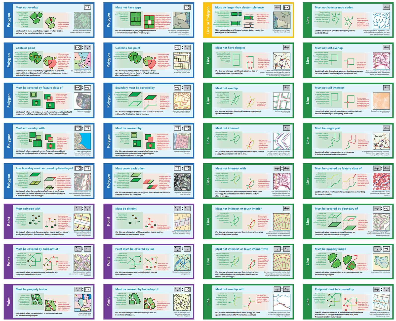
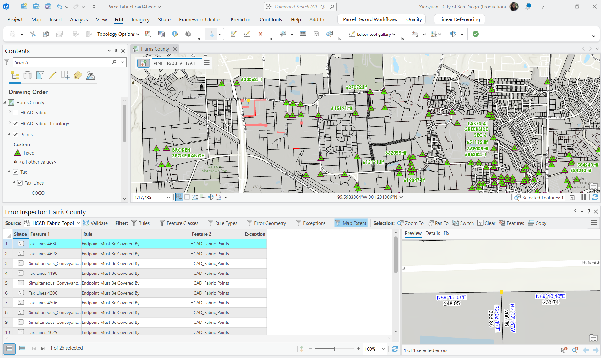
ContextSpatial validation workflows are information-heavy
ArcGIS Pro users validate complex spatial datasets to identify geometry, topology, and rule-based errors. These workflows often involve many records, multiple feature classes, and dense technical information.
Reframing the ProblemFrom managing rows to supporting investigation
The original workflow focused heavily on displaying records.
Through workflow analysis and design exploration, I reframed the experience as an investigation workflow:
overview
filtering
pattern recognition
spatial context
resolution
This shifted the focus from table management toward helping users understand issues more clearly and act more efficiently.
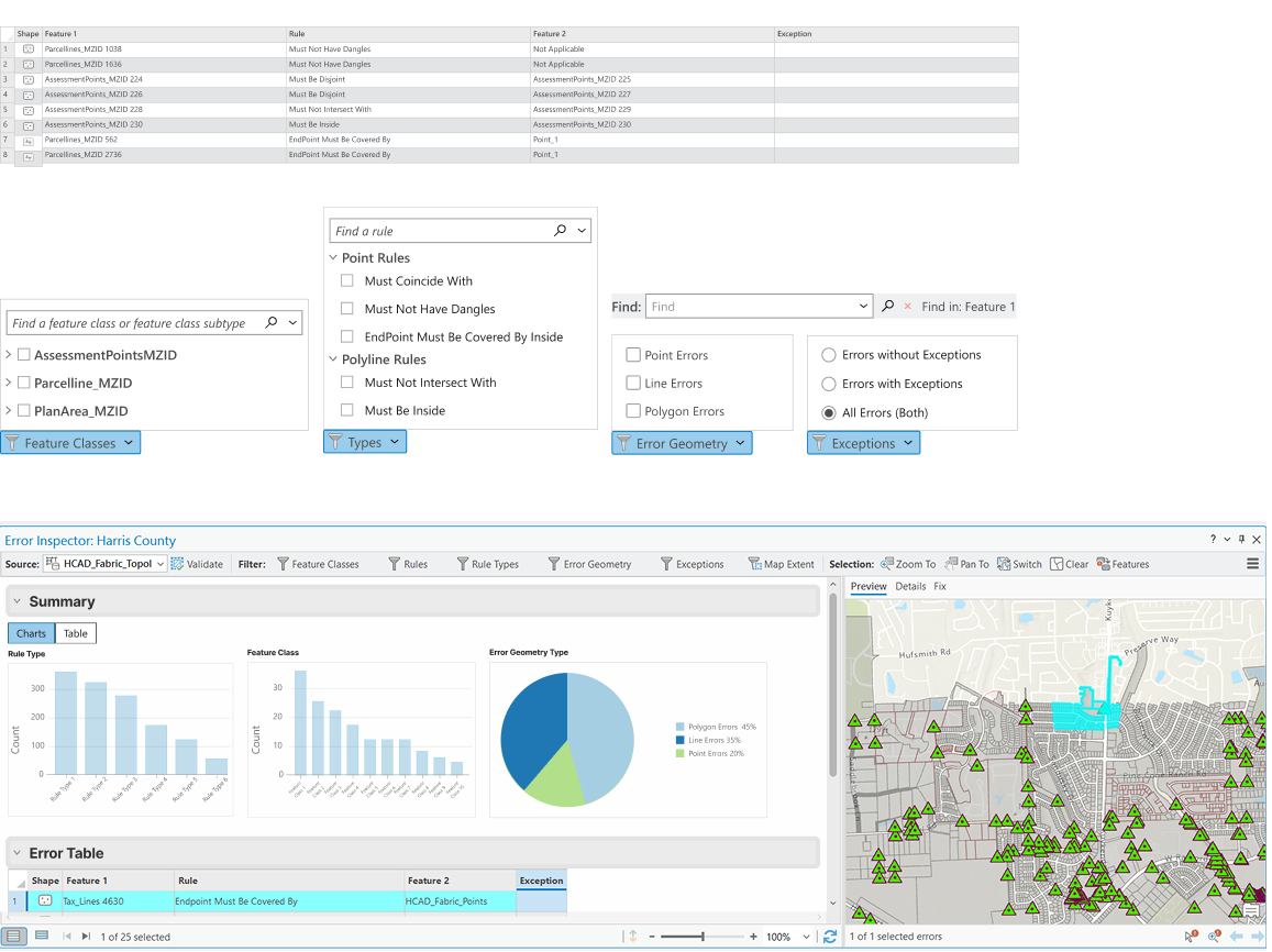
Design DirectionCreating a layered investigation experience
I explored a report-style workflow that helped users move between:
high-level summaries
filtered issue groups
individual records
map-connected investigation
The goal was to reduce cognitive overload while preserving access to detailed technical information.
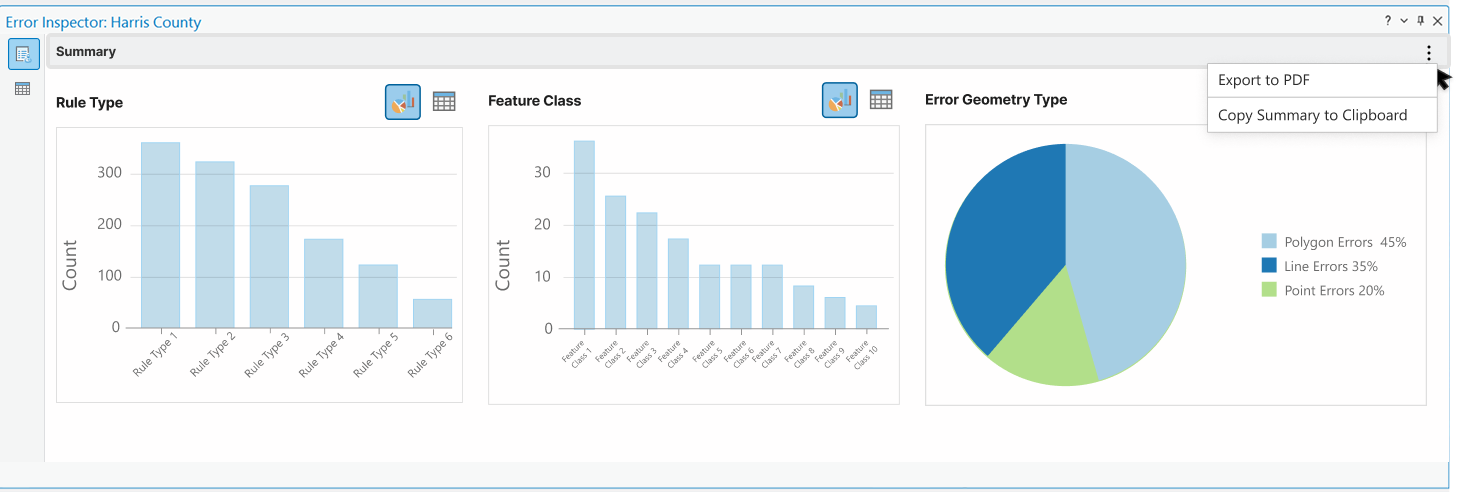
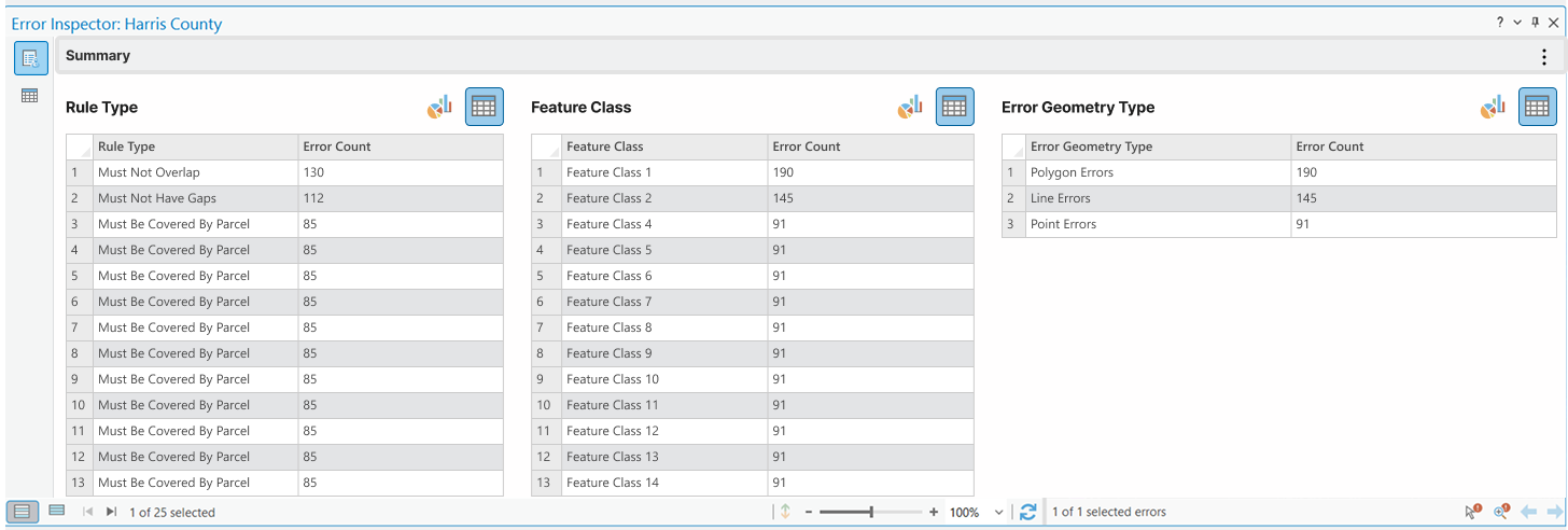
Information ArchitectureOrganizing information by investigation flow
Instead of presenting all records equally, the design introduced a layered structure:
Overview: Understand issue distribution and severity.
Categories: Filter by rule type, feature class, or geometry.
Records: Inspect and resolve individual issues.
Spatial Context: Locate and compare issues directly on the map.
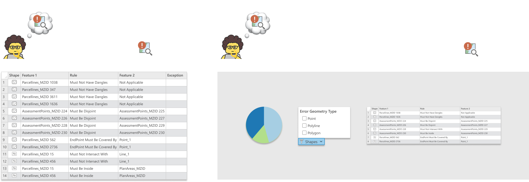
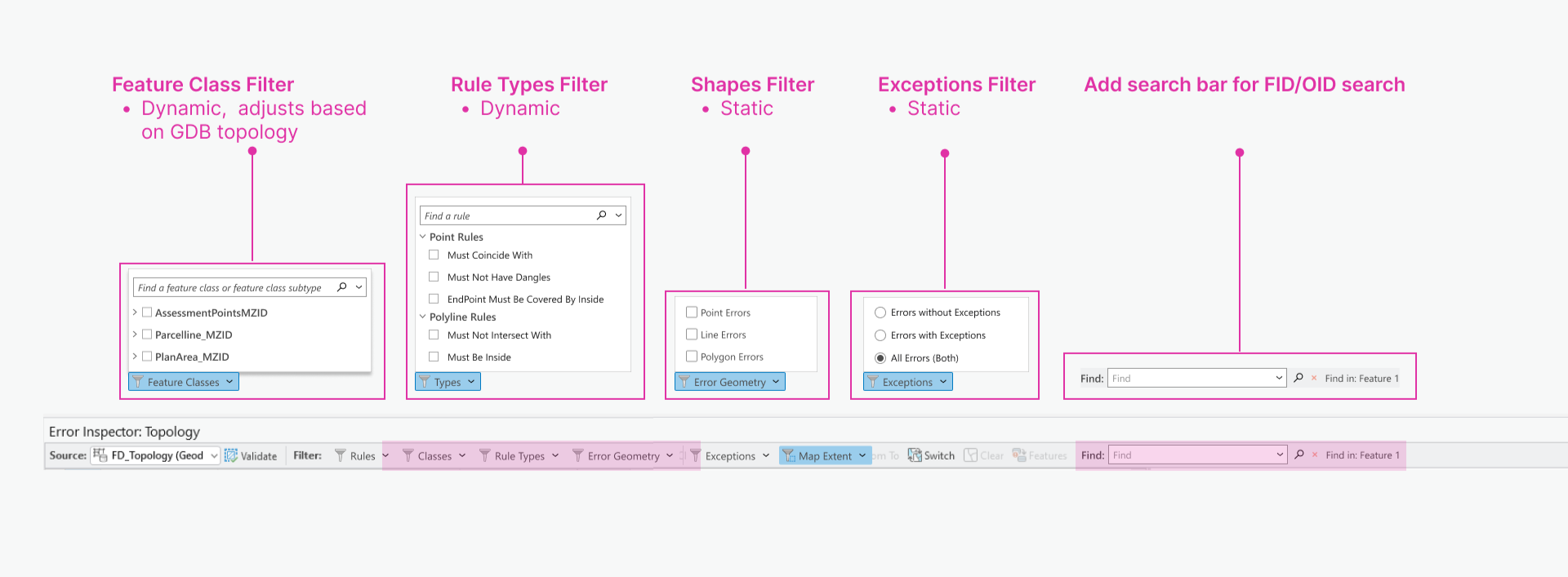
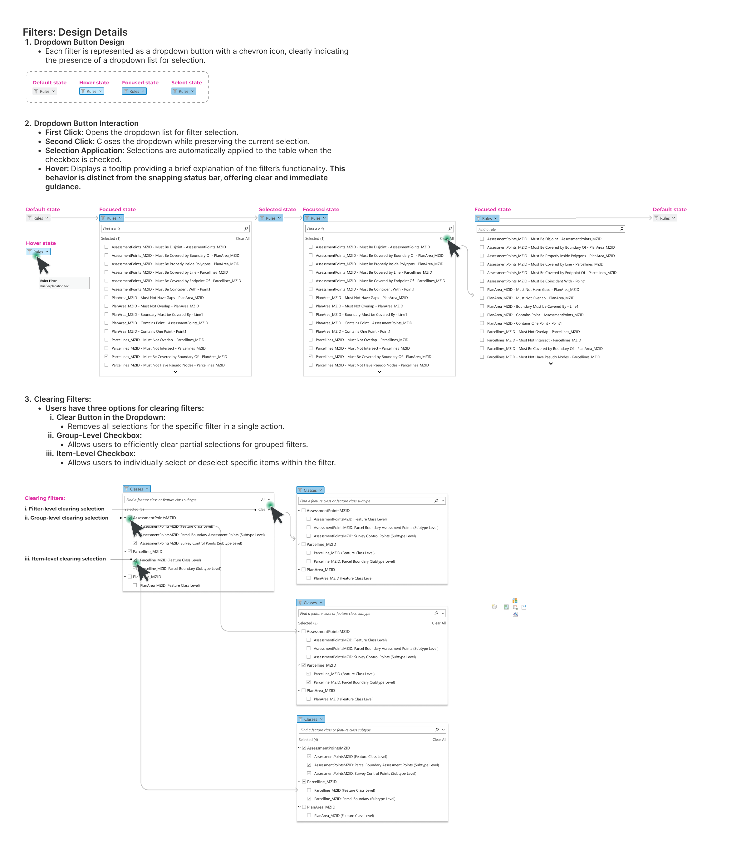
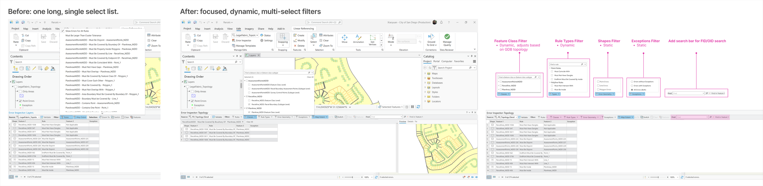
Filtering & SearchSupporting different investigation strategies
Filtering and search were designed to support both:
broad exploration
targeted investigation
This included:
rule-based filtering
feature class filtering
selected-record workflows
Find/Search exploration for known records and IDs
The goal was to help users narrow large datasets without losing context.
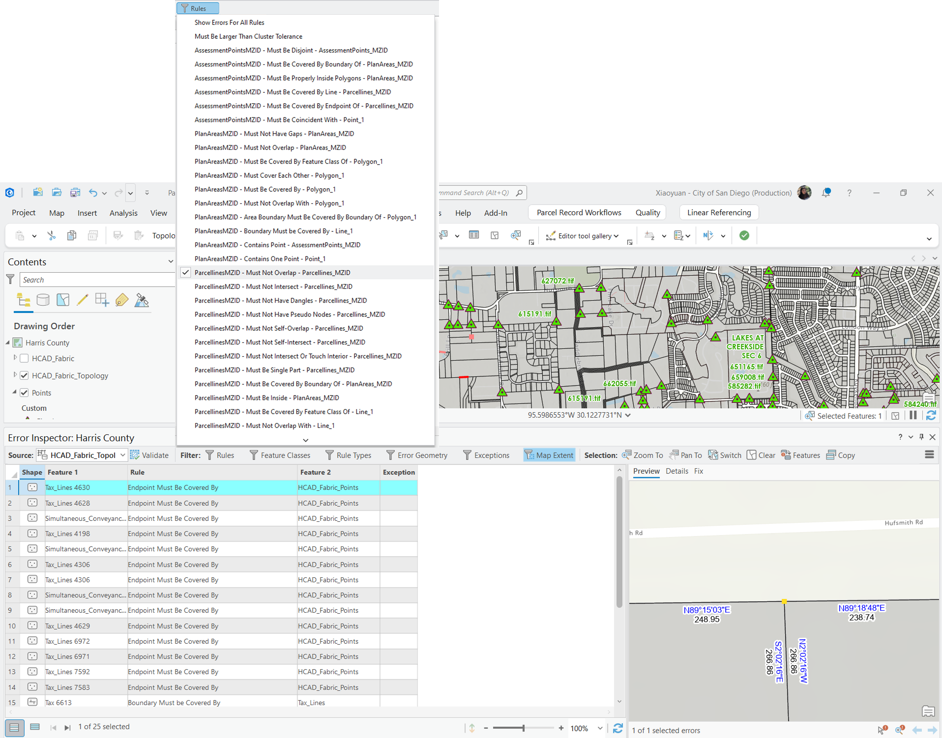
Map + Data CoordinationKeeping spatial context visible
Spatial errors are not only table records. Users need to compare error information with map features, geometry, and surrounding context.
The design explored how table selections, filters, reports, and map views could work together to support investigation and resolution.
OutcomeBuilding a clearer investigation workflow
The project helped shift product discussions from adding more table functionality toward supporting a more complete investigation experience.
The work established a clearer direction for:
layered information hierarchy
summary-driven workflows
structured filtering
map-connected investigation
report-style issue review
ReflectionDesigning for dense spatial information
This project reinforced that complex professional tools do not always need to be simplified by removing information. Often, the real design challenge is creating better hierarchy, clearer entry points, and stronger relationships between overview, detail, and spatial context.
🗺️Up next: Spatial Interaction Systems Across 2D & 3D